Landscape Initiatives
Advancing design and delivery of multi-stakeholder programs for responsible sourcing and natural resource protection on a landscape level
Companies committed to producing and sourcing agricultural commodities responsibly recognize that driving change on the ground requires a multi-faceted approach that includes direct site-level engagement with business partners, as well as interventions at a landscape or jurisdictional scale.
Growing interest in larger scale interventions alongside supply chain approaches reflects a realization that direct supply chain engagement is necessary but not sufficient to advance change at the necessary pace. This is because supply chain approaches in isolation forego synergies that could be achieved through cooperation of multiple buyers operating in the same landscape, and often fail to address the root causes underlying unsustainable practices affecting individual producers.
Landscape approaches require cooperation among multiple parties to define and pursue a shared set of priorities, including not only multiple companies, but also government, NGOs and other local actors. This can be challenging, but it holds potential to create much better and lasting outcomes, that draw upon the strengths of each partner and benefit from shared systems of accountability.
Since 2016 Daemeter has been advancing the design and delivery of such programs in Indonesia. Our aim is to support collaborative landscape programs that leverage the power of multi-stakeholder collaborations to affect durable change across large geographic scales.
This work relies fundamentally on partnerships, but draws upon Daemeter's technical, analytical and engagement expertise in the following:
- Engaging local and regional stakeholders to forge a common set of objectives and facilitate collaboration among companies, sub-national government, NGOs, and civil society
- Deployment of methodologies to assess regions and districts for interventions taking into account enabling conditions and environmental priorities
- Analysis to align and integrate landscape programs with sub-national government policies, plans and platforms, to leverage engagement at multiple levels of government
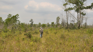
- Mapping biophysical attributes and using neighborhood risk analysis to sub-divide and prioritize landscapes elements based on risk or other determinants of sub-structure
- Mapping the production base at landscape scales, including mill classification systems and interactive risk mapping
- Defining and implementing landscape-wide traceability strategies (TTM and TTP)
- Implementation of smallholder and community development programs
- Prioritization and development of conservation and restoration opportunities.
Our current portfolio of landscape programs include:
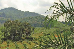
- East Kalimantan. The Penajam Paser Utara district project prioritizes livelihood improvements for oil palm smallholders focusing on better yields, more sustainable practices and increased revenues for farmers and district government.
- Papua and West Papua. Having conducted comprehensive mapping and assessment of palm oil concessions in Papua and West Papua, Daemeter developed a typology of concessions and alternative Green Growth Scenarios for each typology. We have also conducted a screening of jurisdictional risks and opportunities for landscape programming, and designed engagement strategies for select jurisdictions. In 2019, Daemeter has commenced a major 4-year program to support regional governments to improve spatial planning in the context of sustainable development and reduced deforestation.
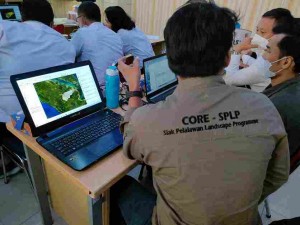
- Riau. Together with Proforest (CORE), Daemeter is establishing a landscape initiative in Siak and Pelalawan districts, driven by a coalition of seven palm oil companies and buyers collaborating to advance a shared vision for deforestation-free and smallholder inclusive palm oil production in the regions.
- South Sumatra. Our work in Musi Banyuasin district is part of broader landscape initiative that is supporting community-based conservation (Kelola Sendang) throughout the province. In support of this, Daemeter has engaged with the local Forest Management Unit (FMU) to develop a model that balances restoration and conservation with revenue-generation from community-based forest management.
Relevant publications:
- Jurisdictional Approaches to Reducing Palm Oil Driven Deforestation in Indonesia
- Jurisdictional Approaches to Sustainable Land Use in Indonesia: What is it, why pursue it and how to build one
Related technical services:
- Site selection and design
- Facilitation of multi-stakeholder forums
- GIS remote sensing analysis
- Government engagement & policy alignment
- Regional development planning
- Supply chain mapping & traceability
- Landscape conservation
- Social inclusion & livelihoods
- Impact monitoring, reporting & KPIs